Long-lasting devastation to livelihoods from damage to agricultural lands in Gaza
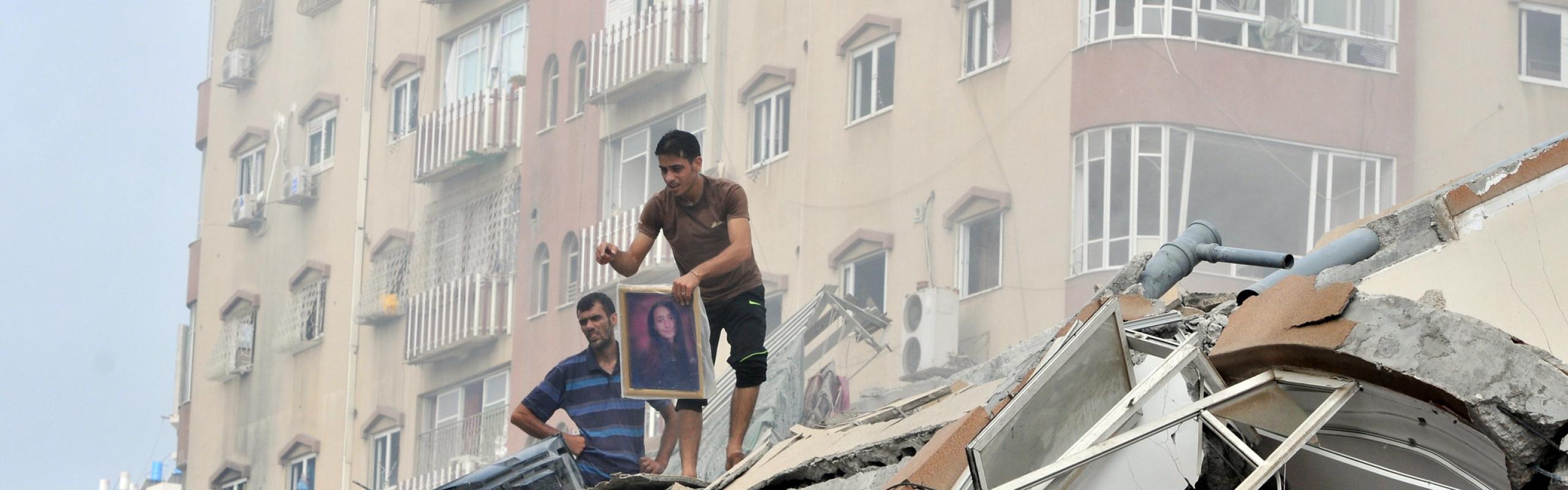
Israel’s continuing attacks against Hamas are causing massive collateral damage to agricultural livelihoods and food supplies in the Gaza Strip. More than one third of agricultural lands in Gaza have been damaged since the outbreak of the war on October 7, 2023, according to analysis based on satellite imagery by the United Nations Satellite Centre (UNOSAT) and the UN Food and Agriculture Organization (FAO).
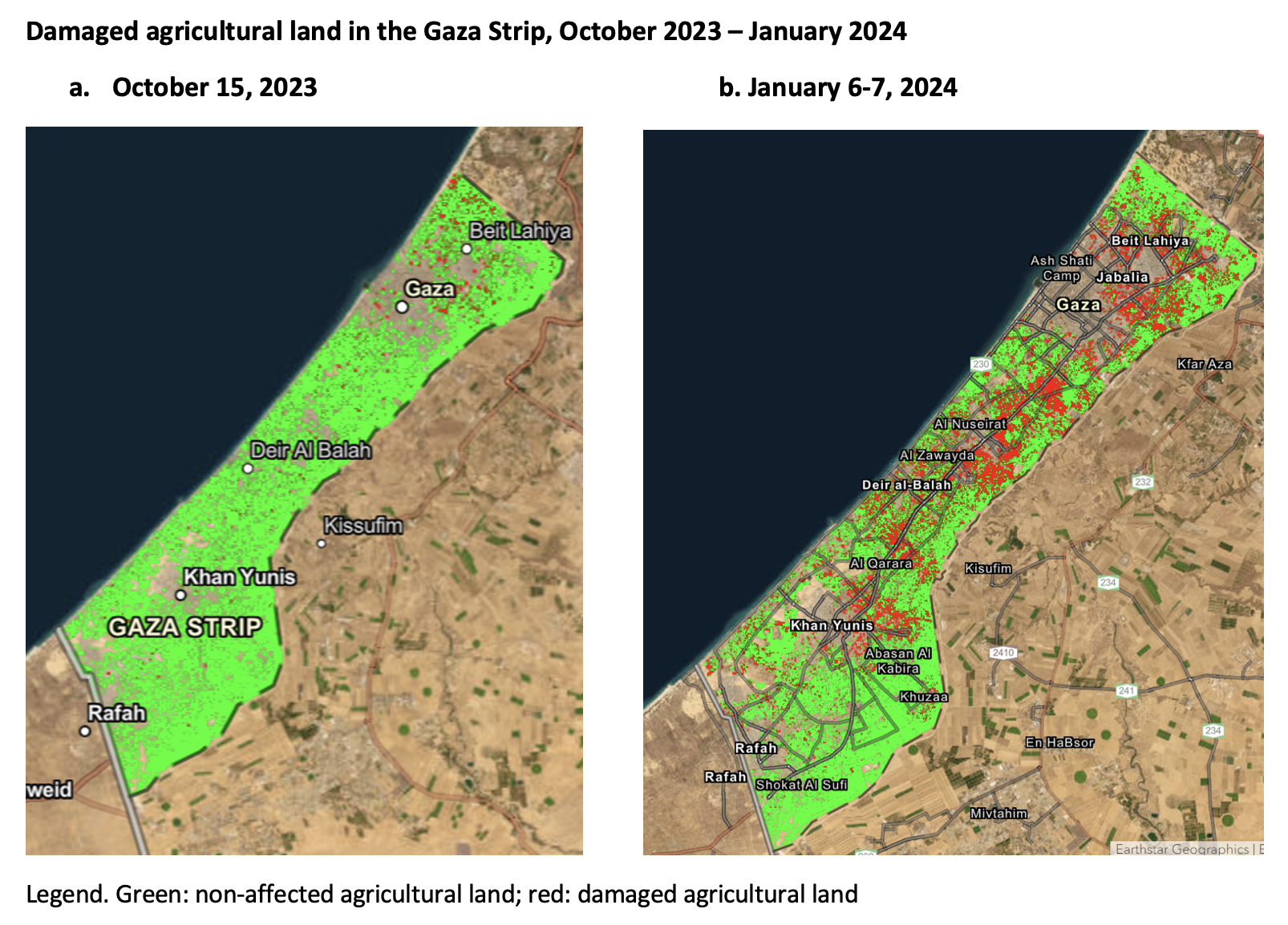
The analysis compares the density and health of vegetation and crops over the past six agricultural seasons, using a method known as Normalized Difference Vegetation Index (NDVI) analysis as well as a multi-temporal classification to identify notable changes taking place in agricultural areas since October 7. Figure 11 compares the situation in early January 2024 to that shortly after the start of the conflict, with damaged areas marked in red.
Figure 1
Source: United Nations Satellite Centre (UNOSAT).
Instructions: Click on "swipe" at upper right and swipe vertical line across the map to show difference between October 2023 and January 2024, or with swipe option off, click on inset map at lower left to toggle between the two dates.
Initially, agricultural land in North Gaza was most impacted, but with the intensification of attacks in Gaza, also the peri-urban areas of Gaza City and the governorate of Deir al-Balah in central Gaza suffered major damage (Figure 2). In Deir al-Balah, more than half of agricultural land was no longer usable for cultivation by early January. Further south in Khan Yunis, an area accounting for 55.6 square kilometers out of Gaza’s total agricultural production area of 178 square kilometers, impacts were initially relatively limited—but by early January more than one fifth of those lands were damaged.
Figure 2
Before the conflict, 53% of Gaza’s agricultural land was used in cultivation of fruits and vegetables, including tree horticulture for olives and citrus fruits. Along with the damage to agricultural land, more than one-fifth of Gaza’s greenhouses and one third of irrigation infrastructure have also been destroyed, while most of the population is displaced. Consequently, a large part of Gaza’s capacity to produce vegetables and fruits is now gone. Production of wheat, the main field crop in Gaza, occurred mostly in North Gaza and Khan Yunis and is thus also significantly affected.
This widespread damage to agriculture is severely constraining food supplies in the Gaza Strip. Before the conflict, about 44% of household food consumption came from domestic producers, according to the Palestinian Central Bureau of Statistics (PCBS), while the remaining 56% came from imports of agricultural commodities, which have stopped due to the conflict. Agricultural products also constituted more than 50% of the territory’s exports.
Reduced domestic food supplies and the loss of import capacity, along with rising costs of transportation, energy, and water, have caused rampant food price inflation (Figure 3). The price of wheat flour, for instance, increased more than tenfold and the average price for vegetables almost fourfold between October 2023 and January 2024, according to recent PCBS estimates (Figure 3). Prices of all other basic necessities have also increased sharply, compounding an already extremely dire situation with nearly all of Gaza’s population facing acute food insecurity and dependent on grossly insufficient food aid.
Figure 3
The widespread damage to agricultural lands, trees, greenhouses, and other basic production infrastructure will not be easy to repair; thus it will likely take many, many years to recover domestic food production capacity and restore the livelihoods that depend on it once the hostilities come to an end.
Rob Vos is Director of IFPRI's Markets, Trade, and Institutions (MTI) Unit; Soonho Kim is MTI Senior Data Manager. Opinions are the authors'.
1. The maps illustrate satellite-detected changes in agricultural areas of the Gaza Strip resulting from the decline in the health and density of crops due to the ongoing conflict. Based on satellite imagery for the area between January 2018 and 2024, UNOSAT conducted a Normalized Difference Vegetation Index (NDVI) analysis as well as a multi-temporal classification to identify notable changes taking place in agricultural areas during that time frame. The methodology evaluated the damage as a substantial decline in the health and density of crops in January 2024, in comparison to the preceding six seasons.